SEA
Seattle–Tacoma International Airport
Arrivals and departures, traced from ADS-B data.
Museum-quality gloss aluminum · fade-resistant · ready to hang.
From $119
![SEA flight path print — Inferno theme · Dark in office setting [hotspot:55]](https://cdn.shopify.com/s/files/1/0818/7710/6930/files/office_861a33d8-28a8-4f6d-a56c-db3cbbb066cc.webp?v=1782613339&width=3840)
![SEA flight path print — Inferno theme · Dark in living-room setting [hotspot:46]](https://cdn.shopify.com/s/files/1/0818/7710/6930/files/living-room_d8847cc3-58a9-468a-8439-6ed0b374a5ae.webp?v=1782613338&width=3840)

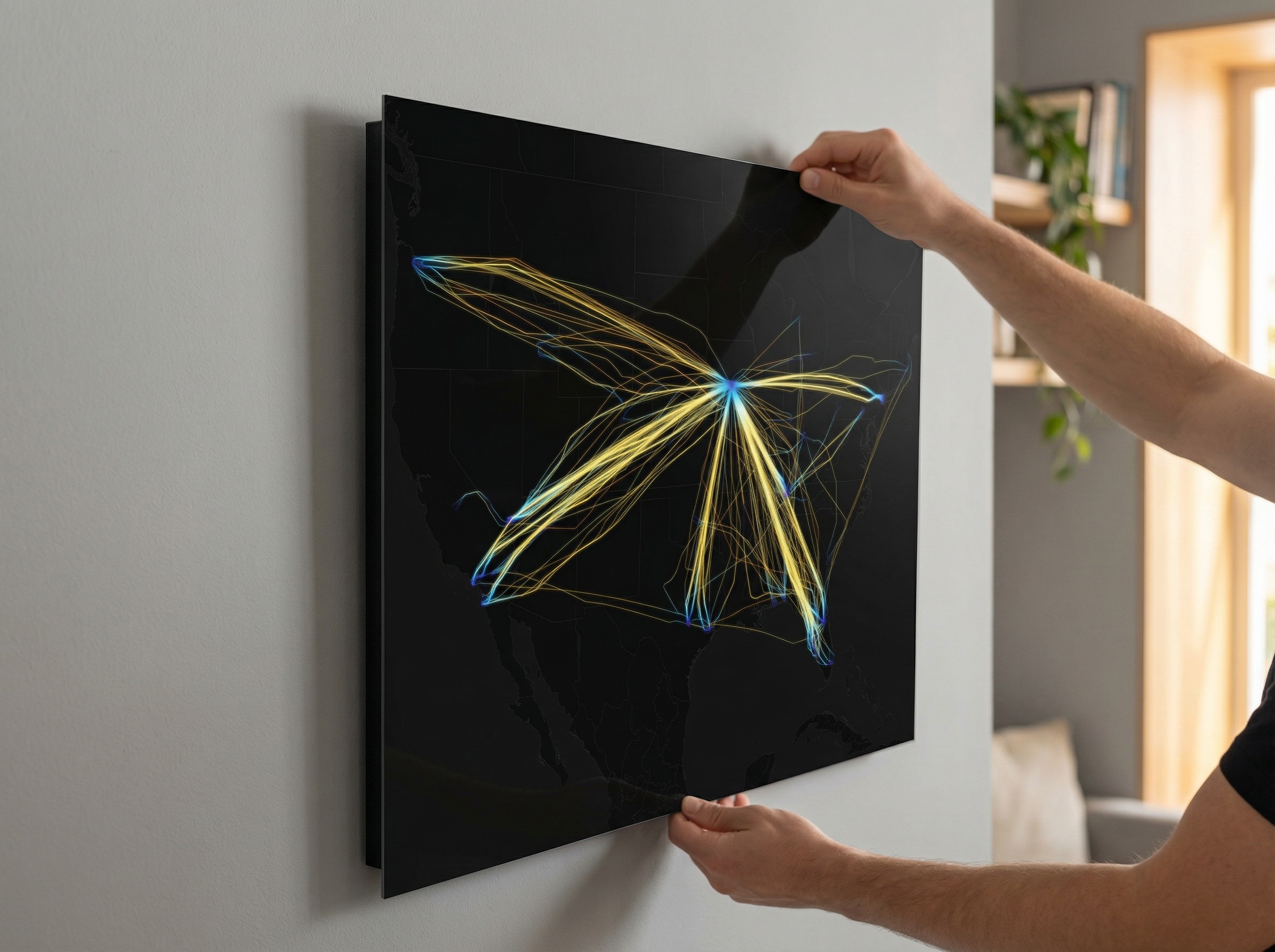
SEA
Seattle–Tacoma International Airport
Arrivals and departures, traced from ADS-B data.
Museum-quality gloss aluminum · fade-resistant · ready to hang.
Seattle-Tacoma International Airport (SEA) sits midway between Seattle and Tacoma and connects the Pacific Northwest to destinations across North America, Asia, Europe, and beyond. This metal print captures that reach, rendered from ADS-B flight tracking data. Every flight path is colorized by altitude, tracing each climb and descent across your chosen color palette.
The print visualizes all 3,649 flights recorded September 1-3, 2025, the 78th anniversary of the first day of scheduled commercial service at Sea-Tac, when Northwest Airlines and Western Airlines inaugurated ten daily departures. Each flight tracked, each flight rendered, direct-to-metal on an aluminum panel.
$119
Free U.S. shipping
- Made in the USA
- Ships in 2–3 Days
- Replaced if damaged
- Secure checkout
What's included
- Gloss aluminum print, float-mount hardware pre-installed
- Companion 8×8 flight-report print — the airport's routes, aircraft, and traffic stats on archival matte fine-art paper
Seattle-Tacoma International Airport (SEA) sits midway between Seattle and Tacoma and connects the Pacific Northwest to destinations across North America, Asia, Europe, and beyond. This metal print captures that reach, rendered from ADS-B flight tracking data. Every flight path is colorized by altitude, tracing each climb and descent across your chosen color palette.
The print visualizes all 3,649 flights recorded September 1-3, 2025, the 78th anniversary of the first day of scheduled commercial service at Sea-Tac, when Northwest Airlines and Western Airlines inaugurated ten daily departures. Each flight tracked, each flight rendered, direct-to-metal on an aluminum panel.
Premium Material
Why Aluminum
Our prints are produced on museum-quality aluminum with a high-gloss finish, the same material professional galleries use.
Dye-Sublimated
Colors infused directly into the aluminum surface, not printed on top.
Deep Blacks, Saturated Color
High-gloss finish holds sharp contrast across the altitude gradients.
Archival Durability
Scratch-resistant, waterproof, and fade-resistant for decades of display.
Modern Float Mount
Included mounting hardware creates a sleek 3/4" float off the wall.
First order
Take 15% off your first print
Drop your email — we'll send your code and a heads-up when we add new airports.