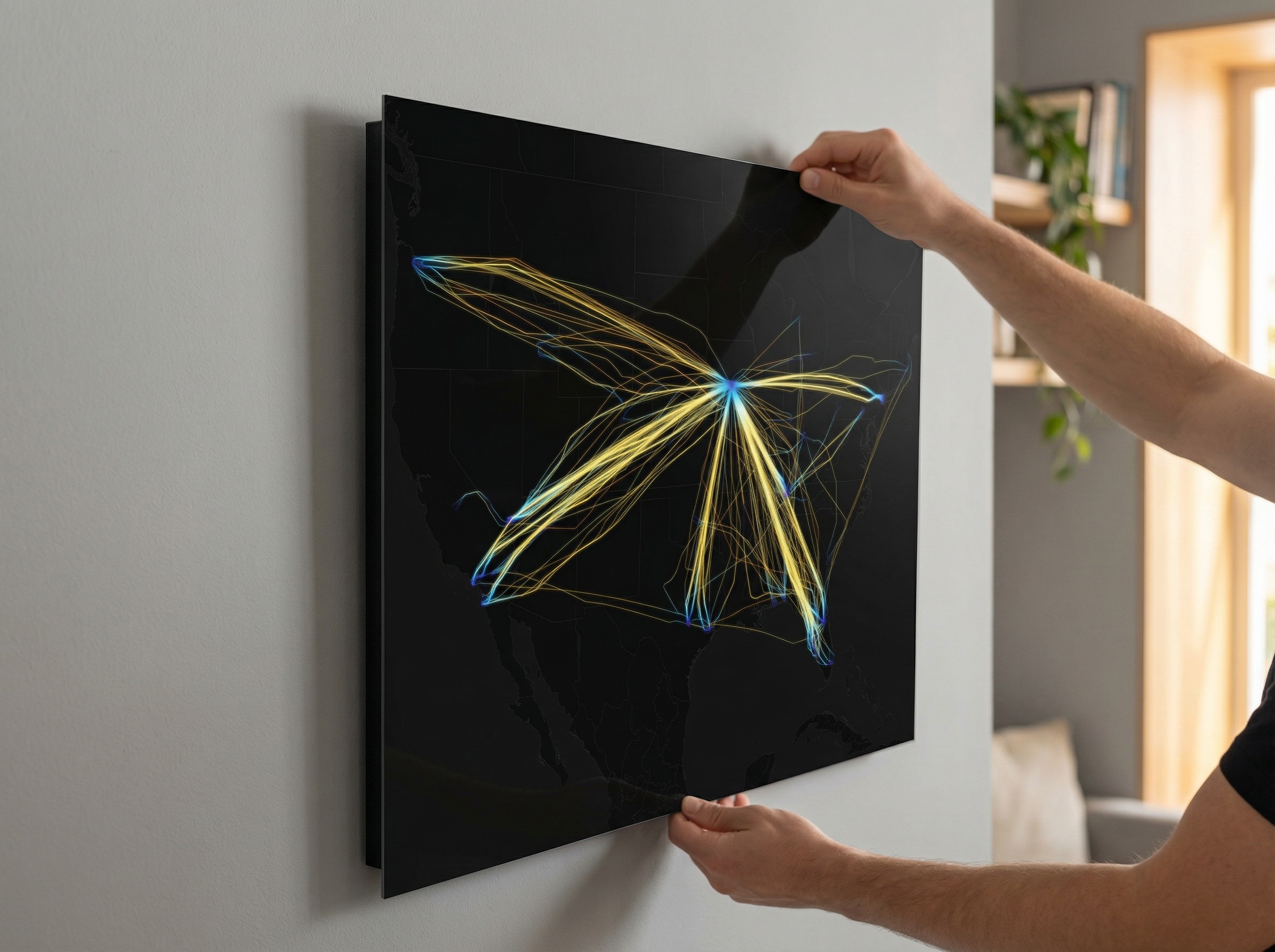
CLT

Charlotte Douglas International Airport

Charlotte Douglas International Airport (CLT) is one of the busiest connecting hubs on the East Coast, funneling traffic between the Southeast, the Northeast, and destinations across the Atlantic. This metal print captures that reach — built from real ADS-B flight tracking data. Every path is colorized by altitude across your chosen palette.

This print renders all 865 flights recorded on January 1, 2026 — the 72nd anniversary of the airport being renamed Douglas Municipal Airport in honor of former Charlotte mayor Ben Douglas. Printed direct-to-metal on an aluminum panel, it is a piece of aviation wall art that ties a day of real movement to a moment of civic memory.

CLT flight path print — Inferno theme · Dark in living-room setting [hotspot:46]CLT flight path print — Inferno theme · Dark in office setting [hotspot:55]CLT flight path print — Solana theme · Dark in living-room setting [hotspot:46]CLT flight path print — Solana theme · Dark in office setting [hotspot:55]CLT flight path print — Citrus theme · Dark in living-room setting [hotspot:46]CLT flight path print — Citrus theme · Dark in office setting [hotspot:55]CLT flight path print — Blossom theme · Dark in living-room setting [hotspot:46]CLT flight path print — Blossom theme · Dark in office setting [hotspot:55]CLT flight path print — Prism theme · Dark in living-room setting [hotspot:46]CLT flight path print — Prism theme · Dark in office setting [hotspot:55]CLT flight path print — Inferno theme · Light in living-room setting [hotspot:46]CLT flight path print — Inferno theme · Light in office setting [hotspot:55]CLT flight path print — Solana theme · Light in living-room setting [hotspot:46]CLT flight path print — Solana theme · Light in office setting [hotspot:55]CLT flight path print — Citrus theme · Light in living-room setting [hotspot:46]CLT flight path print — Citrus theme · Light in office setting [hotspot:55]CLT flight path print — Blossom theme · Light in living-room setting [hotspot:46]CLT flight path print — Blossom theme · Light in office setting [hotspot:55]CLT flight path print — Prism theme · Light in living-room setting [hotspot:46]CLT flight path print — Prism theme · Light in office setting [hotspot:55]

Dye-sublimated on aluminum · Float mount hardware included

$119

Made to order in 2–3 daysMade in the USA
Behind the Print

Every ADS-B-tracked flight visualized in this print — captured on a single day.

865

Total Flights

395

Unique Aircraft

507,024

ADS-B Points

This page visualizes ADS-B flight data captured at Charlotte Douglas International Airport (CLT/KCLT) on January 1, 2026, the 72nd anniversary of the airport being renamed Douglas Municipal Airport in honor of former Charlotte mayor Ben Douglas. Over the course of that single day, 865 total flights were tracked across 395 unique aircraft, averaging 36 flights per hour from midnight through 23:59 EST. The split between arrivals and departures was heavily asymmetric: 667 arrivals versus 198 departures. Traffic was lightest in the early morning hours, with zero flights recorded at midnight and just one between 1:00 and 2:00. The busiest hour was 20:00 local time, which logged 74 total movements, 69 of them arrivals. Routes were distributed broadly across the eastern United States and beyond. Miami (MIA), Chicago O'Hare (ORD), and Orlando (MCO) each tied for the top slot at 17 total movements. Philadelphia (PHL) showed a pronounced arrival skew with 12 arrivals against just 1 departure. The shortest tracked flight arrived from Rock Hill York County Airport (RKH), just 8.7 nautical miles away and airborne for under four minutes. The longest was an arrival logging 3,048.9 nm and 551.9 minutes in the air, originating from Dallas Fort Worth (DFW). One aircraft, tail number N29SB, reached a peak altitude of 46,350 feet on a flight from Kerrville/Kerr County Airport (ERV). Approach traffic came most frequently from the northeast (110 counts) and south (92 counts), with westerly quadrants also well represented. Departure headings were similarly spread, led by south (33) and northeast (26). Altitude data across 507,024 ADS-B position points shows the heaviest concentration below 7,000 feet, reflecting approach and departure phases, with secondary density bands around 29,000 to 35,000 feet. Average groundspeed across all tracked flights was 305 knots, with a maximum of 685.2 knots. Combined flight distance for the day totaled 420,191 nautical miles. Of the 395 unique aircraft, 394 were US-registered and one was German-registered.

Every print includes a QR code linking to the full flight report.

Full Flight Report
Aluminum print showing flight path visualization
Premium Material

Why Aluminum

Our prints are produced on museum-grade aluminum with a high-gloss finish — the choice of professional galleries worldwide.

Dye-Sublimated

Colors infused directly into the aluminum surface for unmatched vibrancy.

Deep Blacks & Vibrant Color

High-gloss finish delivers exceptional contrast and altitude gradients.

Archival Durability

Scratch-resistant, waterproof, and fade-resistant for decades of display.

Modern Float Mount

Included mounting hardware creates a sleek 3/4" float off the wall.

Gallery-Quality Finish

The same premium process used by museums and professional galleries.

About the Airport

Charlotte Douglas International Airport traces its origins to 1935, when the city of Charlotte opened a municipal airfield on the city's western edge. It was renamed Douglas Municipal Airport in 1954 to honor Ben E. Douglas, a former mayor who championed its development. The airport took on its current name, Charlotte Douglas International Airport, in 1982 as international service expanded.

CLT sits roughly 7 miles west of uptown Charlotte, in Mecklenburg County, North Carolina. Its location within the Eastern time zone and its position along the busy I-85 corridor have made it a natural connecting point between the Northeast and the Southeast. American Airlines operates CLT as one of its largest hubs, accounting for the overwhelming majority of flights at the airport and connecting Charlotte to destinations across North America, Europe, and Latin America.

The airport's runway configuration — five parallel runways arranged in a north-south orientation — is one of its most operationally distinctive features, allowing for high throughput in a variety of weather conditions. That layout is visible in the print's geometry, with flight paths fanning out in tight, organized bands from the runway core. CLT consistently ranks among the top 10 busiest airports in the United States by passenger volume. The surrounding region has grown substantially alongside the airport, with Charlotte emerging as a major financial and logistics center that both drives and depends on the connectivity CLT provides.